


Project Overview
SANDAG and Caltrans District 11 are developing a Comprehensive Multimodal Corridor Plan (CMCP) for State Route (SR) 94.
The CMCP will identify strategies to better serve the transportation needs in the project area and reduce vehicle miles traveled and greenhouse gas emissions. We will consider factors such as climate adaptation, land use, transit, local roadways, highways, active transportation, goods movement, flexible fleets, mobility hubs, transportation systems management, social equity, and emerging technologies. SANDAG will collaborate with jurisdictions in the project area, partner agencies, regional stakeholders, tribal governments, community-based organizations, business groups, and the public to develop recommendations to improve traffic flow and build a safe, accessible, and efficient network of transportation options.
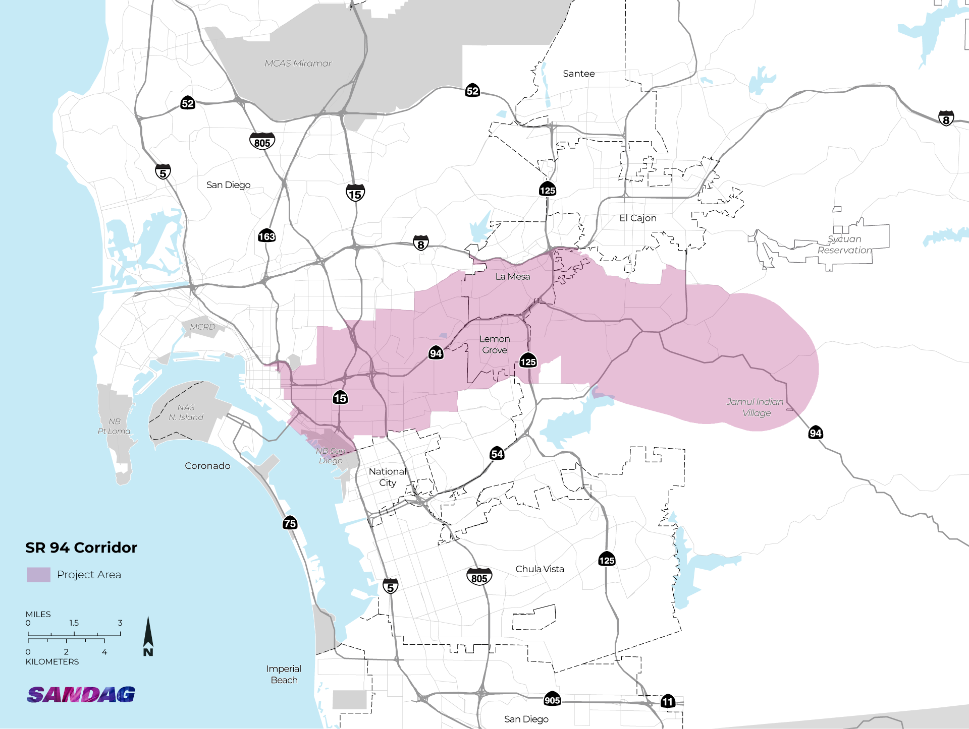
SR 94 is one of the primary east-west routes that people use to travel through Central San Diego. It is an important road for commuters going to and from Downtown San Diego, with high traffic volumes during peak commute periods. It intersects most of the major north-south metropolitan routes, such as Interstate 5 (I-5), SR 15, I-805, SR 125, and SR 54.
The SR 94 CMCP project area extends from Downtown San Diego through the neighborhoods of Greater Golden Hill, Sherman Heights, and Grant Hill, then continue southeast towards Stockton, Mount Hope, Emerald Hills, Encanto, Oak Park, Rolando Park, Webster, and Chollas View. The project area also includes portions of the eastern cities of La Mesa and Lemon Grove, and County of San Diego communities of Spring Valley, and Casa de Oro-Mount Helix, and Jamul/Dulzura, ending at the Jamul Indian Village of California.
Completing the CMCP will help the San Diego region compete for local, state, and federal funds, including Senate Bill 1. We expect to complete the SR 94 CMCP in 2027.
A parallel effort is being conducted to study the SR 94 corridor east of Jamul Indian Village to the Tecate border. The Jamul- Dulzura to Tecate Study will explore current traffic flows on the rural Highway 94 corridor and SR 188. It will also evaluate past transportation solution recommendations to improve roads and freight infrastructure in the anticipation of population growth and development. This study is a separate effort but will be completed in tandem with the SR 94 CMCP.
Objectives
The SR 94 CMCP will create a comprehensive set of safe, sustainable, and equitable transportation solutions that are tailored to the needs of the people who use the corridor and that promote community vitality and improve quality of life. The primary goals of the SR 94 CMCP are to:
- Identify the transportation needs of the people who live, work, visit, and travel through the study area
- Gather input from the community to create solutions that integrate with current development and land use policies while promoting an innovative, resilient, efficient, and accessible multimodal transportation system
- Create a plan that enhances economic vitality, fosters safe and healthy communities, and improves equitable access to jobs, education, and services
Previous Events
On May 27, 2026, Caltrans and SANDAG hosted a public meeting where the public was invited to learn about the SR 94 CMCP project and share input. Watch the meeting presentation.
Connect with Us
For more information on CMCP efforts and ways to get involved, sign up for project updates, or contact the project team at cmcp@sandag.org.